Detailed Maps of Illiana Expressway B3 Corridor
Updated info presented at an August 2013 Meeting at the Will Township building:
Updated Maps of Illiana Corridor B3 (June 2013)
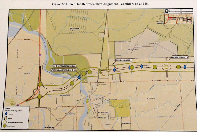
Here are the maps showing the proposed B3 route for the proposed Illiana Expressway. Maps are from the Illiana Corridor Study Draft Environmental Impact Statement:
Updated Maps of Illiana Corridor B3 (June 2013)
Here are the maps showing the proposed B3 route for the proposed Illiana Expressway. Maps are from the Illiana Corridor Study Draft Environmental Impact Statement:
 |
| Add caption |
 |
| Map of the proposed Illiana Expressway Corridor B3 route through Symerton and crossing Cedar Road |
 |
| Map of the proposed Illiana Expressway Corridor B3 route as it connects with I-57 and goes south of Peotone |
 |
| Map of the proposed Illiana Expressway Corridor B3 route as it travels south of Beecher |
 |
| Map of the proposed Illiana Expressway Corridor B3 near the Illinois-Indiana State Line |
 |
| Map of the proposed Illiana Expressway Corridor B3 route as it connects with I-65 in Indiana |
Go HERE for an interactive map of the B3 Corridor.
